

Measuring has never been this simple with the new Trimble X7! We are looking forward to scan all the world in a few minutes and create lots of point clouds that would permit us to measure properties, fronts and wide external areas in detail!
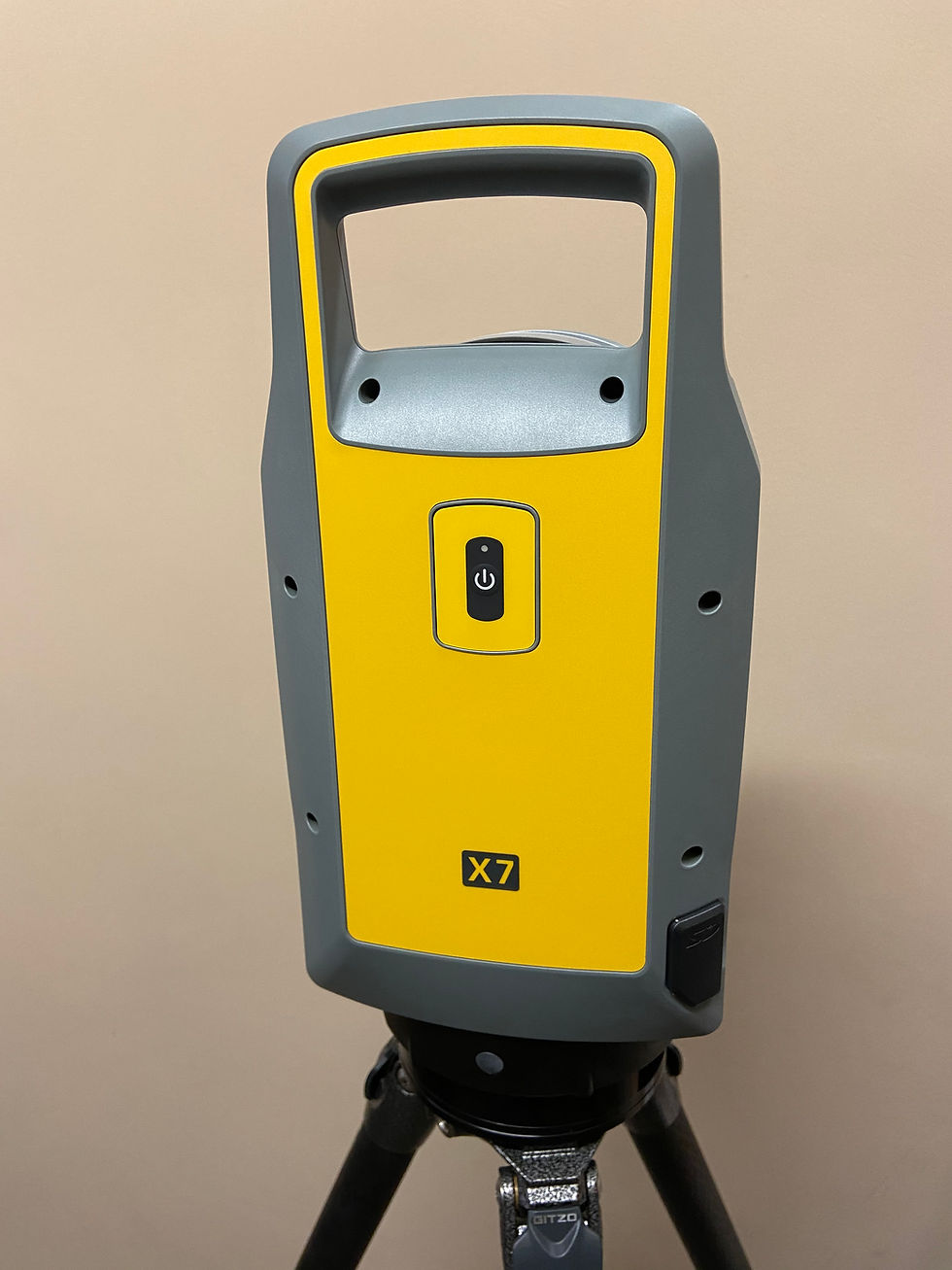
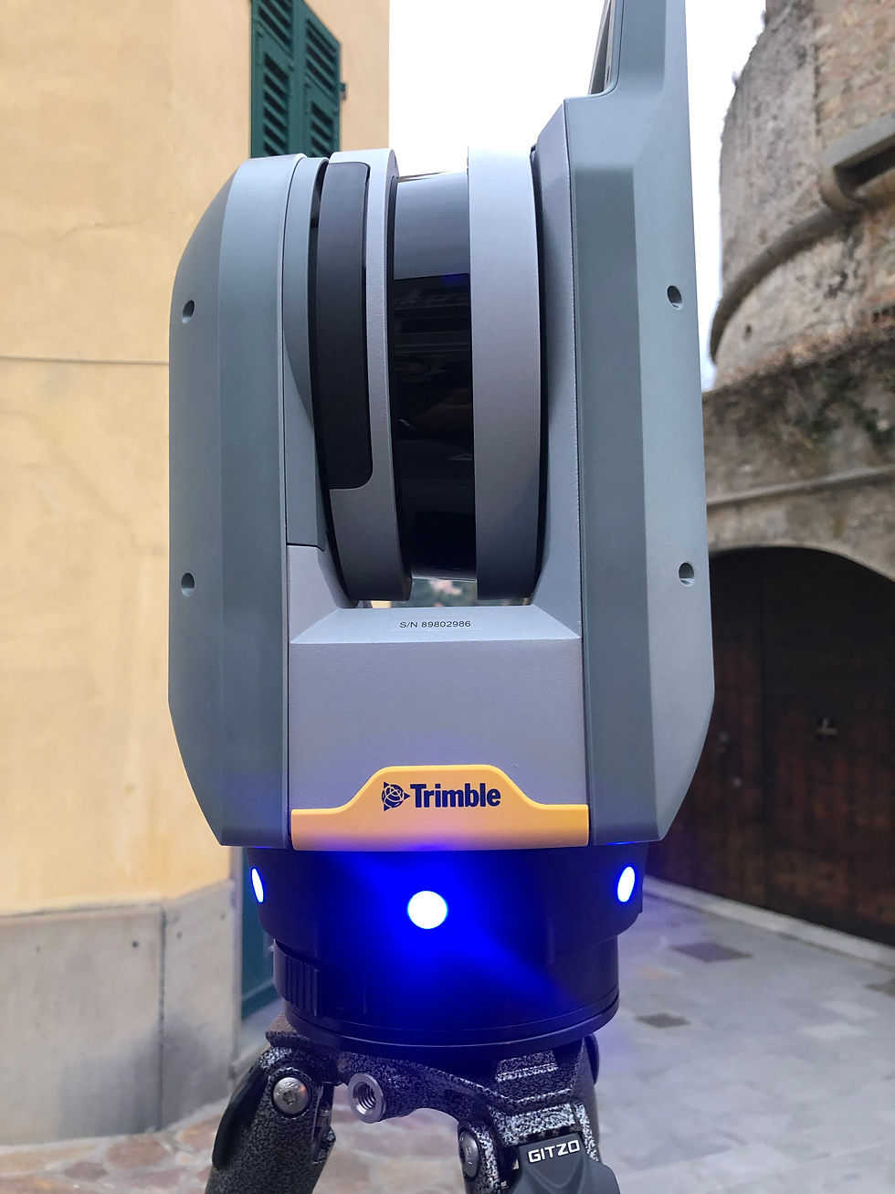
TRIMBLE X7 | Laser Scanners
Unlike other laser scanner this are the strenghts of Trimble X7.
TECHNICAL CHARATERISTICS AND FEATURES:
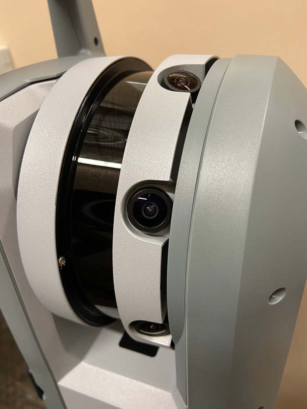
● Automatic Calibration: Smart calibration system. No targets or user interaction required. Registration and calibration are automatic.
● Self-leveling: Automatic survey grade level compensation.
● Registration assist: Increase your field productivity with the most comprehensive automatic registration.
● Laser Pointer: Provide visual confirmation of individual points to be measured by Trimble Perspective
●Georeferencing: Link registered scans to a project coordinate system in Trimble Perspective.
FIELDWORK:
Through the connection between Trimble X7 and Trimble T10 it is possible to work faster with extreme accuracy, and we are also able to see the whole project on the tablet.
In case that we don't own the tablet, it's also possible to scan by pressing the button and then process later on a computer.
The realization of a new project is simple and fast thanks to the software Trimble Perspective, installed on the Trimble T10, which allows you to adjust the different scan settings that the X7 will have to perform and makes the job more accurate and detailed. You can choose the duration and accuracy of the scan from 2 minutes up to 15 minutes for maximum accuracy, in addition to this you can set the shooting of fisheye spherical photographs and their quality. It will be possible to examine and measure distances directly from the point cloud and create cuts to see the inside of the surveyed project, as well as being able to also choose the type of view with which to view the details of the scans. At the end of the survey it is possible to see the completed work on the tablet display with the report showing the processed and recorded data, it is possible to export files in the following formats: E57 – LAS – RCP – POD – PTX – TFZ – TDX but they will still have to be processed on the computer to obtain a definitive result.
TRIMBLE T10 | Tablet with Windows 10


As regards the data processing and their extraction through the point cloud, we proceed with the software Trimble RealWorks which is able to import recorded files and transform them. Through this program we can manage the project, clean up the scans and improve the registration of the stations. The program allows you to section along the three axes or through three reference points, draw, create ortho projections to obtain rectified images, elevations or develop meshes and finally export everything in the following formats: DWG – DXF – DGN – ASC – E57 – LAS – LAZ – POD – PTS – TDX – RCP – OBJ – FBX – XML – TIF.


● ARCHITECTURE
● ENGINEERING
● ARCHEOLOGY
● CULTURAL ASSET
● INFRASTRUCTURE
● SHIPYARDS
● INTERIOR SURVEY
● CAVE SURVEY
● INDUSTRIAL SITES
● TUNNELING
DRONE DJI MINI PRO 3
Volare non è più un limite per noi, grazie al nuovo drone DJI MINI PRO 3 possiamo sfrecciare sul territorio ed eseguire foto e video di qualità ed integrare il rilievo terrestre che eseguiamo già in maniera molto precisa grazie al nostro laser scanner.

Questo drone di ultima generazione possiede incredibili capacità.
CARATTERISTICHE TECNICHE GENERALI:
● Peso al di sotto dei 250gr: grazie al peso di 249gr è possibile manovrare il drone senza bisogno del patentino europeo, ovviamente bisognerà ugualmente rispettare la normativa, ma sarà più facile volare.
● Rilevamento automatico degli ostacoli: i sensori in dotazione al drone ci permetteranno di comprendere l'ambiente circostante ed evitare di scontrarci con ostacoli che potremo vedere dal display.
● Riprese di alta qualità: la risoluzione della fotocamera ci assicura di eseguire video e foto alla massima qualità grazie al 4K e all'incredibile solidità dei 4 rotori ci permettono di rimanere stabili durante il volo.
● Durata della batteria: un volo potrà durare circa 35 minuti grazie alla batteria intelligente durante il quale si faranno tantissimi scatti e video.
REALIZED PROJECTS
N. 4 workstations with Microsoft Windows 10 Pro, connected to each other via a server.
DOCUMENT PROCESSING SOFTWARE:
● Microsoft office 365 | Word, Excel, Power Point and Notes
GRAPHIC DESIGN SOFTWARE:
● Cadline Software | ARCHLine.XP (n. 2 licenses) 2D and 3D certified BIM program
● Trimble | SketchUp 2019 (n. 1 license) 3D modeling and rendering program
● Trimble | Trimble Real Works (n. 1 licence) management program for laser scanner surveys and point clouds
● Trimble | Trimble Perspective (n. 1 license) tablet program for surveys and point clouds
CADASTRAL UPDATE SOFTWARE:
● DocFa | program of the Revenue Agency to update urban databases
● PreGeo | program of the Revenue Agency to update land databases
● Volture | program of the Revenue Agency for changes to land and urban companies/owners
PROFESSIONAL MANAGEMENT SOFTWARE:
● ACCA Software | PriMus (n. 1 licence) for work calculations and accounting
● ACCA Software | CerTus (n. 1 licence) for drafting security plans
● ACCA Software | CerTus-N (n. 1 licence) complementary manual of building safety
● ACCA Software | ConDus (n. 1 licence) management of building amnesty practices
PROFESSIONAL POLICY:
UnipolSai Assicurazioni policy no. 1/61036/122/167755950